

Things To Do!
A free 12 minute video screening that shares the history of Olympic Dam and Roxby Downs, talks through the processing plant and gives a virtual underground tour.
This is available to small groups at any time during our opening hours or for larger groups up to sixty people please contact us and we will provide a suitable time this can be viewed.
The Arid Recovery Reserve, based at Olympic Dam (approx 22km drive from Roxby Downs) is dedicated to the restoration of Australia's arid lands. Arid Recovery is centred around a 123 square km fenced enclosure. Feral cats, rabbits and foxes have been removed from 60 square km of the area leaving some areas as control areas and others as experimental zones.
Arid Recovery was initiated in 1997 and now provides areas of complete protection allowing the regeneration of native vegetation and introduction of five locally extinct mammals (western quoll, greater bilby, burrowing bettong, stick-nest rat and western barred bandicoot). There are now also 15 times as many naturally occurring hopping mice inside the reserve compared to outside.
Arid Recovery, through the dedication of volunteer tour guides, has opened its arid lands ecosystem restoration project to guided tag-a-long interpretive sunset tours where members of the public can experience how vibrant and widely inhabited Australia’s outback was before European settlement. A unique exclusion fence protects the Reserve inside of which cats, rabbits and foxes have been removed, so visitors have a chance to see reintroduced, locally extinct species in their natural habitats and to gain an understanding of the importance of these creatures in the regeneration process. During the sunset tour visitors enjoy activities including identifying tracks, burrows, and plant species and spotlighting after watching the sun set over an ancient landscape.
Arid Recovery Sunset Tours operate on a seasonal basis between April and October on Wednesday and Friday evenings.
Bookings are essential - contact Arid Recovery for more information or to book.
Adults (16+ years) - $60.00 per person
Children (3-16 years / Under 3 years free) - $30.00 per person
Phone: 8671 2402 or visit www.aridrecovery.org.au
Please note - Tours are subject to minimum numbers, road and weather conditions , therefore tours may be cancelled and refunded on the day.
Roxby has many public art displays scattered throughout the town, start by visiting the Roxby Link Art Gallery - located in the hallway between the Library and Cafe. This space showcases both local & external artists.
Richardson Place Mural
Located along the Roxby Auditorium external wall on Richardson Place.
Roxby Downs' large scale mural was completed in June 2022 by artist Sam Brooks. The project, which depicts the Olympic Dam story, was a joint initiative between Roxby Council and the Roxby Business Forum to help revitalise Richardson Place. BHP provided funding for the mural through its community donations program. The video above shows artist Sam Brooks explaining the different elements depicted in the mural.
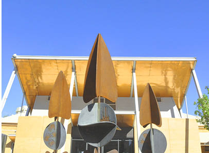
Sturt Desert Pea Sculpture
Located on Richardson Place in front of the Dunes Cafe.
This dynamic sculpture was created by artists Gerry McMahon and Rachel Young, as part of the 'Cargo Public Art Project' - a community cultural development project to commemorate the 20th anniversary of the Roxby Downs Township. More than 400 local young people contributed to the design and development of this sculpture which was fabricated at the Roxby Downs TAFE SA Campus incorporating metals that are local to the region. Launched on Saturday 15 November 2008.
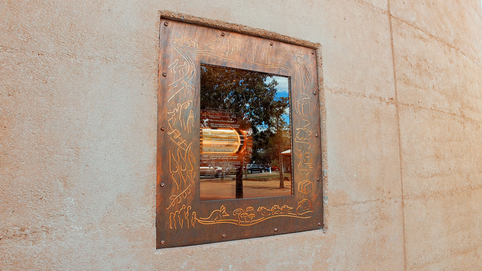
Time Capsule
Located on Richardson Place in front of the Dunes Cafe.
This sculpture is a time capsule that was commissioned by BHP in 2014, and was unveiled in July 2016. The sculpture is an interactive and representative snapshot of the first 25 years of Roxby Downs and was completed over a two year period.
The barrel is a representation of the original mill on the mine site at Olympic Dam.

Kalta Sculpture
Located on Richardson Place in front of the Dunes Cafe.
Keeping an eye on you from up above you will find the Kalta Lizard. The 30th Anniversary sculpture created by the wonderfully talented Andrew Parish and Michael Constantinou of Alchemy Works. Commissioned by BHP, the Kalta or sleepy lizard is the Kokatha’s totem for the region and the sculpture represents a lasting symbol of the strong and enduring connection of the Kokatha people to this area.
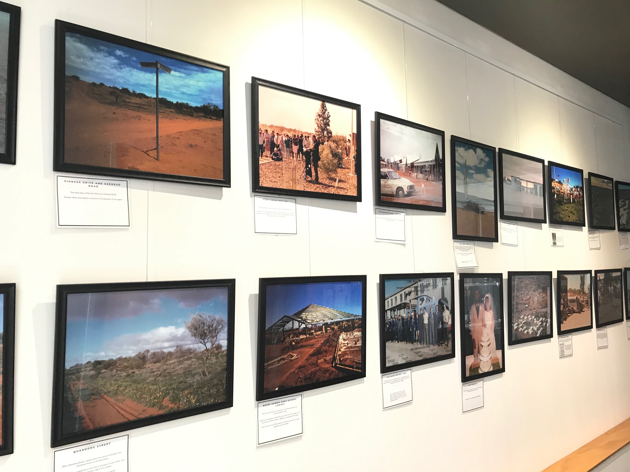
30 Year History Display
Located in the hallway between the Library and Cafe in the Roxby Link Complex.
In November 2018, the whole community came together to celebrate the 30th Anniversary of Olympic Dam and Roxby Downs. This is a photo collection that was put together to highlight how the town has grown over such a short period.
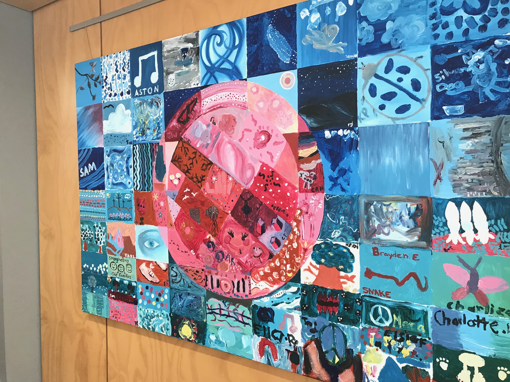
Community Painting
Located in the hallway between the Library and Cafe in the Roxby Link Complex.
This community painting was created as part of the 2013 Red eARTh Festival, which was an initiative of the local Arts & Culture Forum. Members of the community were invited to express themselves, and their sense of belonging to this unique and energetic town, by painting a square within a designated colour scheme and design. The totality of these squares is a response to our local area.
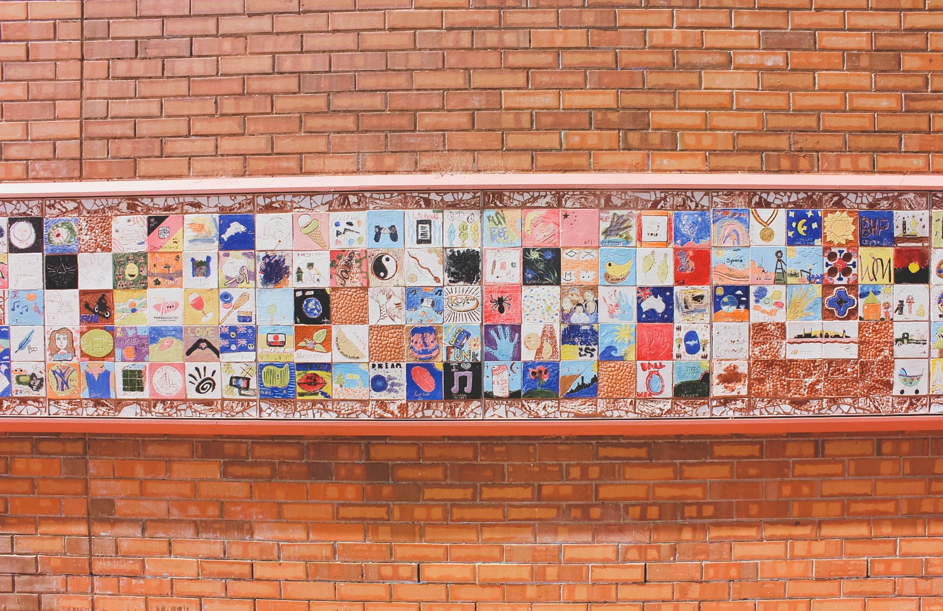
Community Mural
Located just off Richardson Place on the wall of the auditorium opposite the Splashpad
The ceramic Tile Mural was created as part of the 2013 Red eARTh Festival; Celebrating 25 years of the township of Roxby Downs. Many members and community groups contributed their inspiration and ideas.
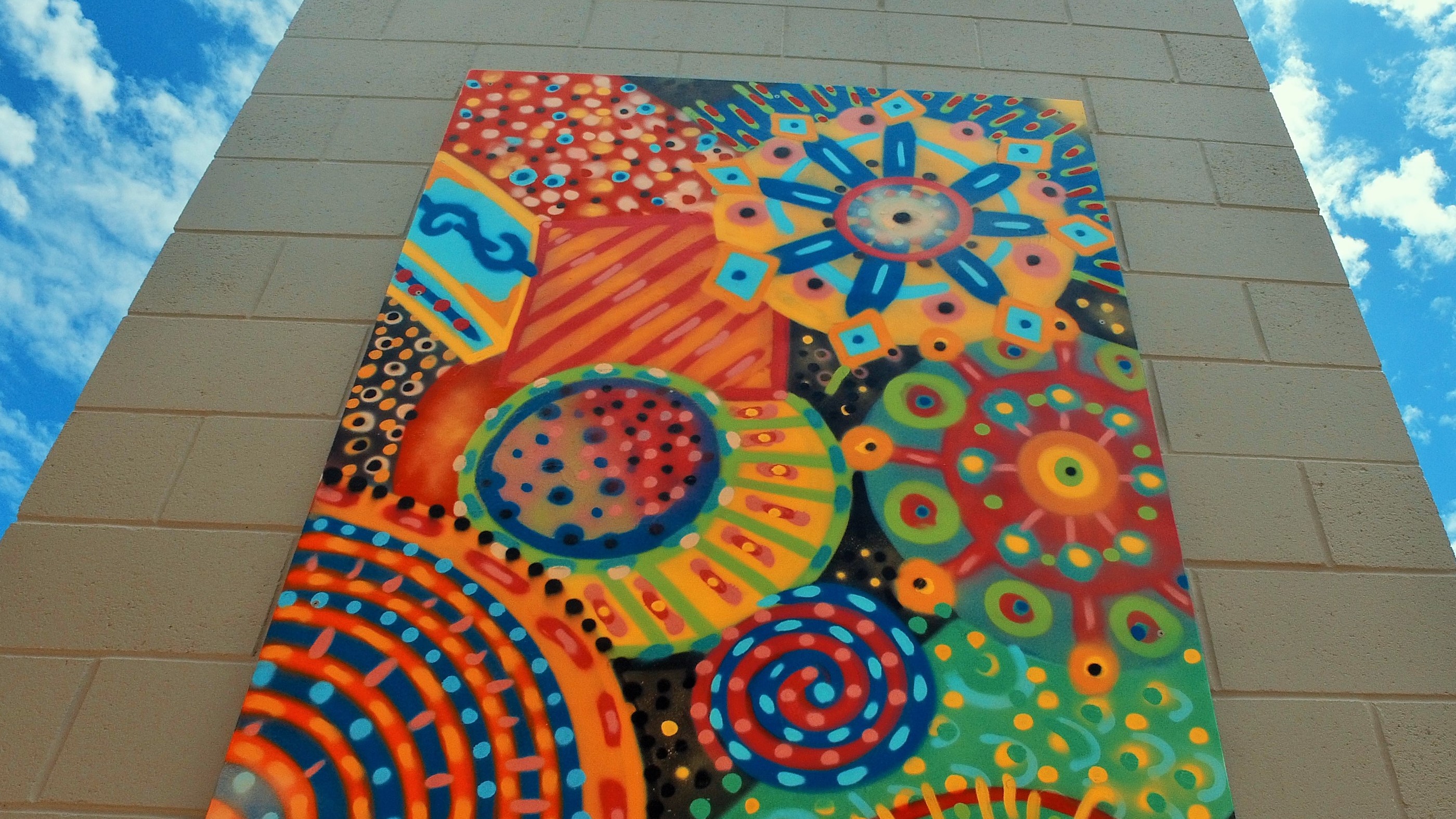
Community Youth Centre Mural
Located at the entrance to the Community Youth Centre just off Richardson Place, behind the Roxby Community Club. On the back of the pillar at the entrance.
This mural was created by budding young artists of students in years 7-12 with the help of SA artist Jack Hodges in 2016. Jack is a muralist, illustrator, digital/video artist who ran workshops over one weekend, leading student through design and ideas through to creation of the piece.
Pick up a town map and head to the smiley faces to check out our local playgrounds!
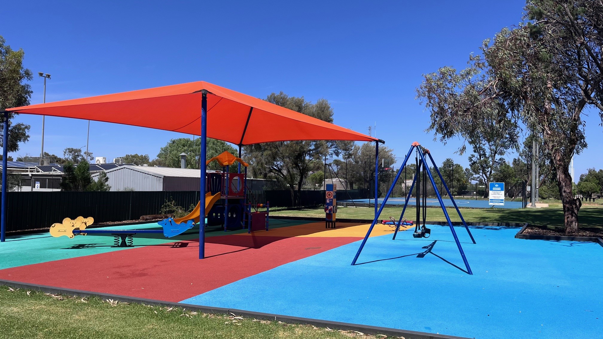
Lions Park - Burgoyne Street (behind the bowls club)
Children's playground including, skate park, half basketball court & tennis courts with adjacent ovals with toilets, picnic tables, BBQ facilities and drinking fountain.
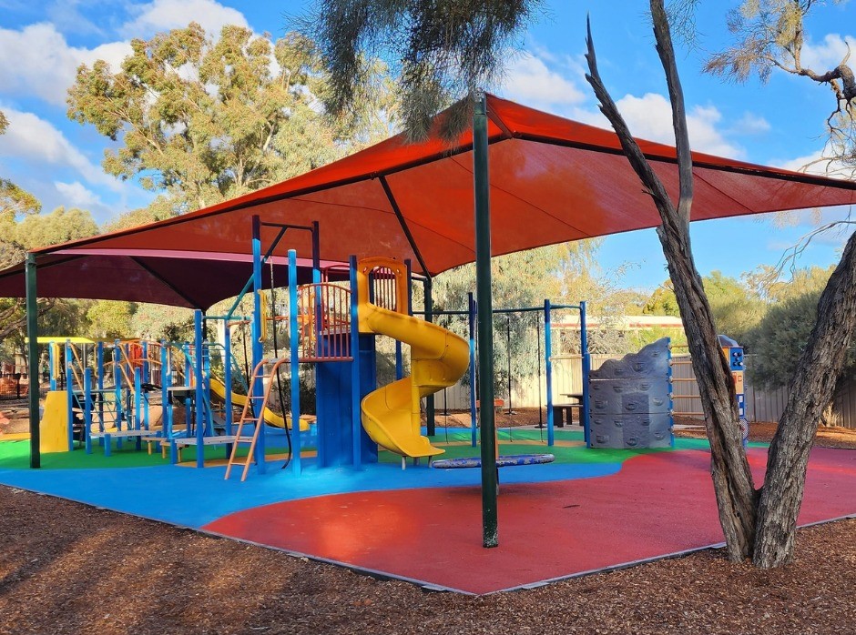
Rotary Park - Curdimurka Street
Fenced children's playground with toilet, picnic tables, BBQ facilities and drinking fountain.
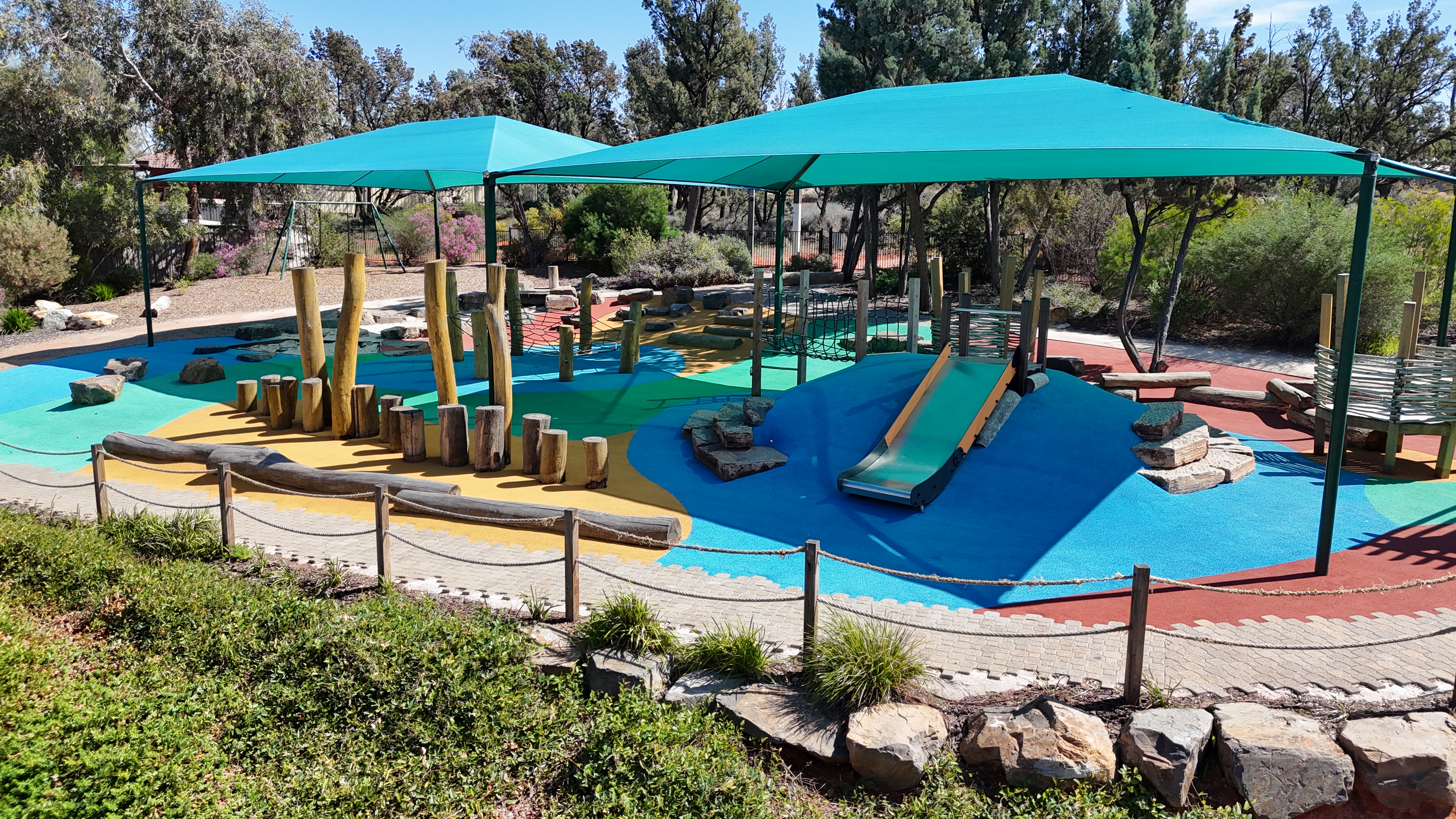
Nature Play Space - Hermit Street
Fenced children's playground with toilet, picnic tables, BBQ facilities and drinking fountain.

Gidja Munda Pump Track - Cnr Burgoyne Street & Olympic Way
Bring your bike, scooter or skateboard and try out the modular track - comprising of 3 individual tracks providing for all skill levels from beginner to intermediate and advanced.
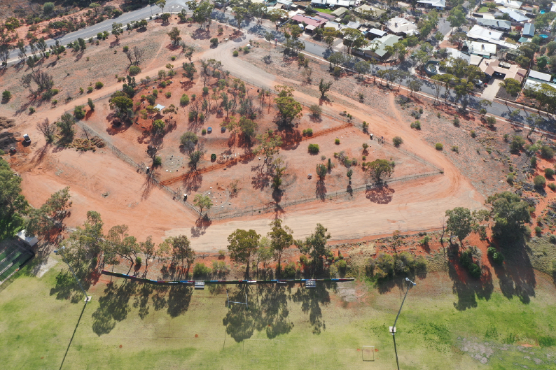
Off Leash Dog Park - Cnr Pioneer Drive & Olympic Way
Fully fenced with a separate section for small dogs and another section for all dogs. The dog park is a great area to exercise your pet. Your dog will love a run around the labyrinth of painted posts, hiding behind the large cotton wheels or climbing a landscaping rock.
The dog park has pet watering fountains at the entrance points and doggy bags to pick up after your dog.
The Emu Walking Trail is a 3 kilometre circuit trail. The head of the trail is on Richardson Place outside of the Dunes Cafe, however you can start the walking trail at any point along the circuit.
The Emu Walk winds its way around residential Roxby Downs, through the community garden, over sand dunes and through nature reserves. The trail is marked with directional markers. Along the trail you will see different species of native trees as well as a glimpse of the Olympic Dam mine.
Interpretive signage is installed along the trail, so allow time to stop and read the signs and learn about our unique town.
Trail Information
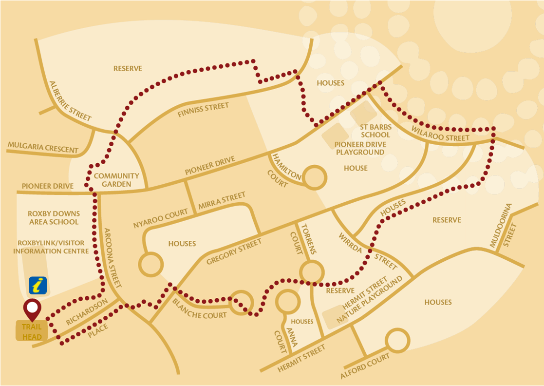
Length: 3 kilometres
Time: approximately 1 hour
Grade: low - moderate
Terrain: gently undulating sand dunes with bitumen paths
Season: all seasons
Signage: directional arrow markers
All trail users
- Take sufficient water per person to safely complete the journey.
- Water fountains are located at intervals along the trail
- Wear sunscreen, a hat, study walking shoes and appropriate clothing
- Please respect private property and the environment
- Move quietly near wildlife
- Please dispose of rubbish in the bins provided
We would like to acknowledge the Kokatha peoples, the traditional owners of the land on which we meet today and pay our respects to their Elders past and present and extend that respect to other Aboriginal and Torres Strait Islander people who are present today. Traditionally the Kokatha people have been associated with the land to the north of Port Augusta, from Lake Torrens in the east to the Gawler Ranges in the west. In September 2014, the Kokatha People were formally recognised as the Traditional Owners of a large section of land in the north of South Australia. is includes the land surrounding Roxby Downs, Olympic Dam and three pastoral stations; Roxby Downs, Andamooka and Purple Downs.


Golf Club - located on Olympic Way
Green fees payable by card at the back of the clubhouse
Squash Courts - located within the Roxby Link complex on Richardson Place
Courts and equipment available to hire from the Roxby Link Kiosk ($$)
Tennis / Netball Courts - located adjacent to Lions Park behind the Roxby Link complex
Four multipurpose tennis / netball courts are available for public use (when not booked)
Swimming Pools - located within the Roxby Link complex on Richardson Place
Facilities include: Heated Indoor Pool (16.6m), Outdoor Pool with beach entry and water features (25m), Zero Depth Splashpad
Fees apply, check with Roxby Link for operating times: 8671 0500.
24 Power Fit Gym - located on Tutop Street
Check their Facebook page for staffed hours to sign up
Roxby Link is a Business Unit of Roxby Council which provides leisure, recreation, and cultural support and services to the community. The Roxby Link Complex houses local leisure centre consisting of splashpad, indoor & outdoor swimming pools, library, auditorium, cinema, café, art gallery, indoor stadiums, squash courts, ovals, tennis courts, community youth centre, and provides visitor Information.
All facilities are available to the public at a casual fee. Find out more at the Roxby Link Kiosk 8671 0500
Andamooka is an Opal mining town situated roughly 30kms from Roxby Downs with bitumen roads all the way.
With a rich history there is plenty to explore in this little town. Attractions include; historical cottages, historic mining machinery display, the Andamooka Tiger, underground opal and mineral museum and public noodling area.
Look on the back of the Roxby Downs town map for a map of Andamooka & pick up a brochure of what to see.
Accommodation Options
Dukes Bottlehouse Motel
Opal Creek Blvd. Town hub. (Post office)
Phone: (08) 8672 7007
Andamooka Caravan and Camping Ground - Corner of Water Road and Opal Creek Blvd.
Facilities include; hot showers (coin operated), toilets, potable water (some fees apply), undercover BBQ kitchen, shade shelter, playground and skate ramp. $4 per person per night or $12 per night powered for two people, payment is by honour system in a collection box adjacent to the BBQ kitchen.
Andamooka Retro Short Stay Shacks
Take a step back in time to a more relaxed pace. Short term family and pet friendly accommodation for up to 6 people.
Call 0427 508 075 to find out more.
Tours
Andamooka Observatory can customise tours to include: Night Mining, Black lighting & Naked Eye Astronomy. Call 0487 112 747 for bookings and enquiries.


Sturt's Deset Pea (Swainsona Formosa)
The Floral emblem of South Australia
ID: Unmistakable when in flower. Flowers usually red with black centre (“boss”), but the colours of the petals and boss can vary from red to pink and white.
Where to see: After rain; town verges and Borefield Rd.
Sturt's Desert Pea's are protected in South Australia. Look but don’t touch! Please leave them for others to appreciate.

Andamooka Lily (Crinum Flaccidum)
ID: Up to 50cm tall, with distinctively pretty pale-yellow flowers. Very smelly, also known as the Stink Lily.
Where to see: After rain in summer and autumn in creek lines and flood plains in Andamooka.

Hopbush (dodonaea viscosa ssp. Angustissima)
ID: Large shrub, similar at first glance to Sandhill Wattle, but has far “waxier” leaves. Seed capsules can be vividly coloured, with four “wings” to help with winddispersal.
Where to see: Common on sand dunes.

Poached Egg Daisy (Polycalymma Stuartii)
ID: Small herbs, 10-50cm tall, with long, thin stems and gorgeous "poached egg" flowers.
Where to see: After rain on sand dunes

Cypress Pine (Callitris Glaucophylla)
ID: Up to 18m tall, the only pine tree in the area. Young trees are symmetrical and coneshaped, becoming less symmetrical with age.
Where to see: Olympic Way - between Roxby Downs and Olympic Dam. Pines in the area have been aged to 250 years old.

Western Myall (Acacia Papyrocarpa)
ID: Tree up to 7m tall, often with neat, round and shady canopies.
Where to see: Flat ground, often near bluebushes. Corner of Olympic Way and Borefield Rd, Stuart Highway between Pimba and Coober Pedy.

Mulga (Acacia Aneura)
ID: Up to 10m tall, with needle-like leaves. Flowers are spike shaped and bright yellow.
Where to see: Dune edges, Arid Recovery.
Elaborate processing allowed Indigenous Australians to use this plant to create pastes and “bush lollies”.

Cannonball (Dissocarpus Paradoxus)
ID: Small herb, less than 50cm. Flowers and “fruit” are woolly and spherical, with many spines. Wool falls off when fruits are on the floor.
Where to see: Flat swales, mulga patches. Easy to find if barefoot! (Another reason to always wear closed-in shoes in the bush)

Pearl Bluebush (Maireana Astrotricha)
ID: Blueish-grey shrub. Leaves shorter than 1cm, oval-shaped and succulent.
Where to see: Flat, hard soils (“swales”) between sand dunes.
Lives up to 300 years. Leaves are high in protein and salt and can be overgrazed by rabbits and livestock.

Bladder Saltbush (Atriplex Vesicaria)
ID: Low shrub, 40-80cm high. Leaves flat and roughly triangular, becoming fleshy after rain. Flowers “bladdery”.
Where to see: Flat, hard soils (“swales”) between sand dunes. Salt lake edges.
Leaves edible (tastes salty!)

Sandhill Wattle (Acacia Ligulata)
ID: Large shrub, normally 1-2m tall. Circular, bright yellow flowers. Creates long seed pods, which are often visible on plant long after the seeds have popped out.
Where to see: Common on sand dunes.
Roxby Downs closest neighbours are Andamooka, Woomera and Pimba. We are also a gateway to the Outback with the Borefield Road leading you to the Oodnadatta Track. You can explore the many railway sidings, ruins, natural artesian springs and Kati Thanda-Lake Eyre National Park along with the towns of William Creek, Marree and Oodnadatta.
William Creek
Just over 250kms (on unsealed roads) from Roxby Downs you will reach one of the smallest towns in Australia, William Creek. William Creek marks the half way point between Marree and Oodnadatta along the famous Oodnadatta Track.
The town is situated on the world's largest cattle station - Anna Creek Station, and sits 60 kms from the nearby Kati Thanda-Lake Eyre National Park. Operating out of William Creek is the company Wrightsair providing scenic Flights over Lake Eyre and the nearby painted Hills during all seasons. You can learn about the history of the Old Ghan Railway line, view the outdoor museum showing a small collection of rocket memorabilia from the Woomera Rocket Range or simply relax in the historic William Creek Hotel.
Marree
Sitting at the junction of the Birdsville and Oodnadatta Tracks at just over 180kms drive (on unsealed roads) from Roxby Downs you have Marree. The historic town gives you an insight into past days, see the old mail truck used by renowned Outback mailman Tom Kruse at the Museum Park and also visit the Marree Hotel that hosts the Tom Kruse Collection, a tribute to the legendary Birdsville mailman. Visit the Arabunna Aboriginal Community Centre for authentic artefacts and fossil displays. The Marree Hotel offers friendly outback service and can organise a scenic flight to be taken over Lake Eyre.
Oodnadatta
The town for which the Oodnadatta Track was named situated 450kms North (on unsealed roads) of Roxby Downs has to this day retained much of its pioneering character. Main attractions of the town include the Pink Roadhouse, they offer updated road conditions, maps and outback travel advice. You can learn how the town once worked at the Rail Station Museum or test your skills of low tyre pressure driving on the amateur driving loop before crossing the Simpson Desert.
Points of Interest along the Oodnadatta Track
Here are our top picks of places to stop in at along the Oodnadatta Track. Before you go make sure you are well prepared with extra food, water and spare tires in case something goes wrong. And check the current road conditions here: www.dpti.sa.gov.au/OutbackRoads
Lake Eyre South Lookout – A large parking bay with interpretive signage about the area, walk out onto the salt expanse (no camping, majority of the time there is no water here)
Curdimurka Railway Siding – View the railway building, water tower, desalination plant, fettlers cottages and Stuart Creek Bridge are still standing and are in reasonable condition, given their age and the harshness of their location.
Coward Springs - Lovely shaded campground with small natural spa (29 degrees), walking trails, museum.
Mound Springs – permanent natural springs that have popped up from the great artesian basin, the Bubbler is a great little spring that does exactly what it says - bubbles! (no swimming / no camping)
Strangway Ruins – Strangways was the site of the first homestead on the pastoral property of the same name (it’s now called ‘Anna Creek’ and is the biggest pastoral station in the world). There are ruins to explore as well as two walking trails. Additional brochures are available at this site to guide you.
Algebuckina – Large railway bridge and sometimes waterhole on the western side of the track. Great spot for photos and camping here. On the eastern side of the track there is a more permanent water hole.
Approximate Travelling Times and Distances
Minimum times you should allow in good weather.
Roxby Downs to Bopeechee (Junction of the Borefield Road and the Oodnadatta Track) 1.75 hours | 122kms
Bopeechee to Marree 1.25 hours | 65kms
Bopeechee to William Creek 2.00 hours | 134kms
William Creek to Coober Pedy 2.00 hours | 160kms
William Creek to Algebuckina 2.00 hours | 143kms
Algebuckina to Oodnadatta 1.00 hour | 56kms
Oodnadatta to Marla 3.00 hours | 208kms
Oodnadatta to Coober Pedy 2.50 hours | 190kms
Oodnadatta to Dalhousie Springs 3.50 hours | 179kms
Dalhousie Springs to Kulgera 3.00 hours | 355kms
Woomera is situated approximately 80kms from Roxby Downs with Pimba an additional 8kms.
Stop in to learn about Woomera's fascinating history, head to the Woomera Heritage Centre to visit the Rocket Range Museum and Outback Diner or test your skills at Woomera Bowl, walk through Woomera Missile Park or relax at Breen Park.
Accommodation Options
Eldo Hotel - Kotara Crescent
Phone: (08) 8673 7867
Woomera Baker Observatory
Open Friday evenings after dark, weather permitting. For more information regarding viewing times or bookings follow Woomera Baker Observatory on Facebook.
For further information about Woomera contact the Woomera Heritage Centre - 8673 7042
Pimba
A small settlement that sits at the junction of the Stuart Highway and Pimba Road that leads onto Woomera, Roxby Downs and Andamooka. Spuds Roadhouse offers a range of services and facilities including; petrol station, bar, restaurant, accommodation and gaming.
Accommodation
Low cost unpowered camping and caravan sites are available and Deluxe Motel Rooms
For more information contact Spuds Roadhouse - (08) 8673 7473